RIEL seminar series
LiDAR remote sensing of riparian vegetation: Deriving structural and functional tree information
| Presenter | Dr Rafael Bohn Reckziegel | |
|---|---|---|
| Date |
|
|
| Time |
to
|
|
| Contact person | E: RIEL.outreach@cdu.edu.au | |
| Location | CDU Casuarina campus, Yellow 1.1.39 and online | |
| Open to | Public | |

The first section of this seminar will discuss tree structure and function by means of terrestrial light detection and ranging (LiDAR) and related technologies.
Before now, understanding of forest resources has been restricted to the simplicity of tree measurement techniques. In recent years, terrestrial LiDAR has gained attention as a means for a more accurate and non-destructive assessment of tree and plot scale biomass (also woody volume and carbon), while uncovering tree form with a level of detail not realised by competing technologies. The uncovered tree structure is now being used to understand the function of trees in certain ecosystems. Meanwhile, operationalising point cloud methods still must overcome a few hurdles to extract information from three-dimensional data in a short time. As an introduction to the research field, all these aspects are put in the context of agroforestry systems, which are structurally diverse and dynamically evolving systems.
The seminar's second half will cover LiDAR remote sensing of riparian vegetation.
Much has been shown in the field of LiDAR technology, covering the multitude of laser sensors and platforms (airborne, spaceborne, ground-based LiDAR) for the study of woody vegetation. However, research efforts have not yet covered all of the many ecosystems worldwide, as many of the currently developed protocols and methods are not adjusted to the varied vegetative structures. The combination of multiple sources of information and processing workflows also creates space for technological improvement.
In the context of the project “LiDAR Remote Sensing of Riparian Vegetation”, the aims are to explore the structural complexity of riparian vegetation in the Top End and other locations in Australia, where ongoing research on groundwater-dependent ecosystems and on tree-water relationships have been reported. A crucial step is to identify, fine tune, or even develop approaches for quantifying foliage characteristics and conditions of the woody vegetation. Moreover, a look at the understory conditions and deposition of coarse woody debris might be fundamental to understanding system dynamics. Finally, tree structural information will be extended to plots and upscaled at landscape level.
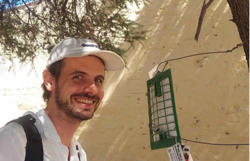
Dr Rafael Bohn Reckziegel is a research fellow in remote sensing riparian vegetation who is working on the Charles Darwin University-CSIRO partnership along with RIEL's Prof Lindsay Hutley as well as CSIRO's Dr Shaun Levick and Dr Tanya Doody. Dr Bohn Reckziegel has a background in forest sciences and LiDAR remote sensing for deriving tree structural and functional information from three-dimensional data acquired from terrestrial platforms.
Related Events
Boring beetles and super models: mapping the distribution of a new invader
The polyphagous shot-hole borer (PSHB) is a tiny beetle with a mouthful of a name, but it’s been making headlines as a new invasive species in Australia. PSHB was first detected in Perth three years ago and has since devastated trees across the city. There are concerns about what its further spread could mean for urban, agricultural and natural environments.
Read more about Boring beetles and super models: mapping the distribution of a new invader
Groundwater: Hidden wonder of the Northern Territory
The seminar ‘Groundwater: Hidden wonder of the Northern Territory’ will be presented in two parts. First, Steven will provide a basic explanation of what groundwater is and concepts of how groundwater systems operate. He will then give an NT-wide view of groundwater properties and processes.
Read more about Groundwater: Hidden wonder of the Northern Territory
Carbon and water adventures in north Australia
With climate change and increasing land use pressures there is more and more demand for knowledge of carbon dynamics and water use as well as water resource management. Lindsay’s research is focused on providing better understanding of the biophysical environment of tropical land and water systems.
Read more about Carbon and water adventures in north Australia